
‘Pokémon Go’ players have been unknowingly training delivery robots
- Leveraging augmented reality gameplay data to enhance robotic navigation accuracy.
- Utilizing crowdsourced images to overcome GPS limitations in urban environments.
- Integrating Visual Positioning Systems (VPS) for precise last-mile delivery operations.
- Continuous real-world data collection as a strategy to improve autonomous robot performance.
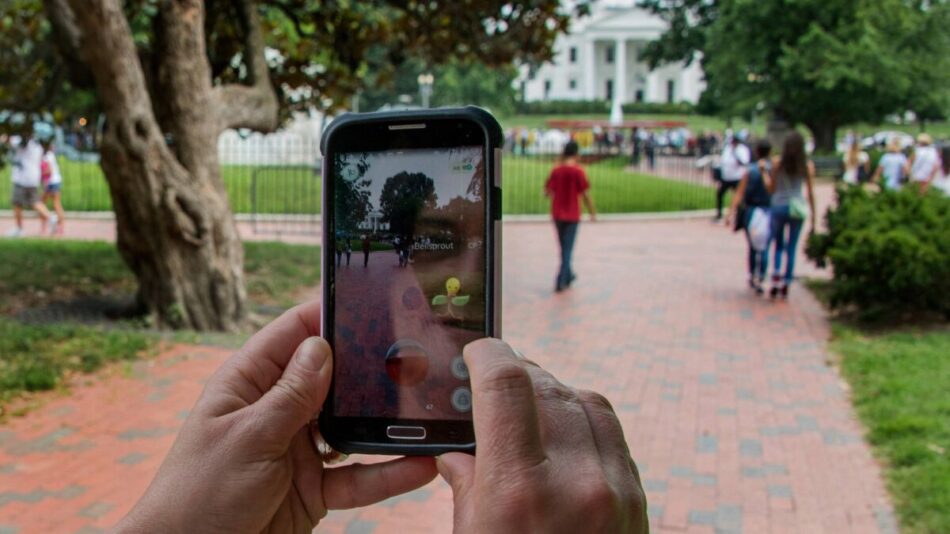
Nearly a decade after its launch, the augmented reality game Pokémon Go has evolved beyond entertainment to become an unexpected contributor to the field of robotics navigation. Players, while capturing virtual creatures, have inadvertently generated a massive dataset of over 30 billion images. This dataset is now powering Niantic Spatial’s Visual Positioning System (VPS), which is being deployed to improve the precision of delivery robots operating in complex urban environments.
This innovative use of crowdsourced data addresses the limitations of traditional GPS navigation in dense cityscapes, enabling robots to identify their exact location by analyzing nearby landmarks. The partnership between Niantic and Coco Robotics exemplifies how game-generated data can be repurposed to solve real-world challenges in autonomous delivery, promising enhanced efficiency and reliability for last-mile logistics.
Continue Reading
How ‘Pokémon Go’ Data Powers Delivery Robot Navigation
The core technology enabling this breakthrough is Niantic’s Visual Positioning System (VPS), which uses image recognition to determine precise locations based on visual cues rather than relying solely on GPS signals. Unlike GPS, which can suffer from inaccuracies especially in urban canyons created by tall buildings, VPS analyzes the surroundings captured through cameras to pinpoint location within a few centimeters.
During the peak of Pokémon Go’s popularity, millions of players roamed diverse environments, capturing images of landmarks, streets, and parks. These images were not only used to place virtual creatures but also to build detailed 3D maps of real-world locations. The introduction of “Field Research” in 2020 further encouraged users to scan statues and landmarks, enriching the dataset with multiple angles and lighting conditions.
The Role of Crowdsourcing in Building Accurate Maps
Crowdsourcing provided a unique advantage by collecting data from a vast number of users across different times, weather conditions, and perspectives. This diversity of data enhances the robustness of the VPS model, allowing it to recognize locations under various scenarios. The repetition of scans from multiple users also helps in refining the 3D models, making them more reliable for navigation purposes.
This approach mirrors the data collection strategies used by self-driving car companies, which rely heavily on continuous real-world data to improve their autonomous systems. Niantic’s use of game-generated images is a novel example of how entertainment technology can contribute to practical applications in robotics and artificial intelligence.
Challenges of GPS in Urban Delivery and How VPS Addresses Them
GPS technology, while ubiquitous, faces significant challenges in dense urban areas. Tall buildings often block or reflect satellite signals, causing location errors that can mislead autonomous delivery robots. Such inaccuracies can result in robots getting lost, delayed deliveries, or even safety hazards when crossing streets.
Niantic’s VPS, combined with Coco Robotics’ hardware equipped with four cameras, enables robots to “see” their environment and navigate more intelligently. By recognizing landmarks and buildings, robots can maintain accurate positioning, avoid obstacles, and choose optimal paths to deliver food and groceries efficiently.
Impact on Last-Mile Delivery Efficiency
Last-mile delivery is notoriously challenging due to unpredictable urban environments and the need for timely arrivals. The integration of VPS technology promises to reduce delivery times and improve customer satisfaction by minimizing navigation errors. This technology also supports scalability, as robots can adapt to new environments without extensive manual mapping.
Ethical and Privacy Considerations in Data Repurposing
The repurposing of user-generated data raises important questions about privacy and consent. While Pokémon Go players contributed images primarily for gaming purposes, these images are now being used to train AI models for commercial applications. Niantic has not indicated plans to share VPS data with law enforcement, but the potential for such use highlights the need for transparent data policies.
Users should be aware that participation in augmented reality games can have unintended consequences beyond entertainment. Companies leveraging crowdsourced data must balance innovation with ethical data management to maintain public trust.
The Future of Autonomous Delivery and Continuous Learning
Niantic and Coco Robotics envision a “living map” that continuously updates as robots collect new data during deliveries. This feedback loop enhances the VPS model’s accuracy over time, enabling robots to adapt to changes such as construction, new buildings, or altered landscapes.
This continuous learning approach aligns with broader trends in machine learning and robotics, where real-world data streams fuel ongoing improvements. As autonomous delivery becomes more prevalent, such adaptive systems will be crucial for maintaining reliability and safety in dynamic urban settings.
Scalability and Commercial Viability
The partnership demonstrates a scalable model for integrating augmented reality data into commercial robotics. By leveraging existing user bases and gameplay mechanics, companies can gather valuable datasets without incurring prohibitive costs. This strategy accelerates development cycles and enhances return on investment for autonomous delivery solutions.
Summary of Key Benefits and Business Implications
- Augmented reality data offers a rich source of real-world images for training AI navigation systems.
- Visual Positioning Systems improve location accuracy where GPS is unreliable, reducing delivery errors.
- Crowdsourced data collection enables continuous model refinement, supporting long-term scalability.
- Ethical data use and privacy remain critical considerations as repurposing expands.
- Enhanced last-mile delivery efficiency can drive customer satisfaction and profitability.
Frequently Asked Questions
Call To Action
Explore how integrating augmented reality data and advanced AI navigation can revolutionize your delivery operations and enhance customer satisfaction in the evolving landscape of autonomous logistics.
Note: Provide a strategic conclusion reinforcing long-term business impact and keyword relevance.